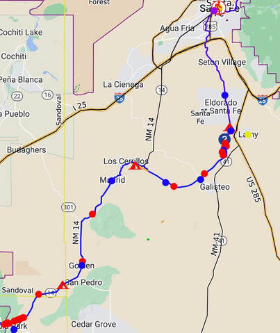
Between Santa Fe and the Sandia Mountain Wilderness:
- I took the main rail trail bike path south out of Santa Fe. A few camping options would be about 15 miles south of Santa Fe.
- I walked along some railroad tracks and then along New Mexico Highway 14 through the historic town of Madrid to avoid a ton of private land. Madrid was a cool town and worthy of routing the trail through. I continued along Highway 14 until I basically reached the Sandia Wilderness. The longest stretch of continuous private land along the entire FCL is from Santa Fe to the Sandia wilderness. This section has a lot of road walking to get around private land, so if it is possible to get easements across some of the large ranches in the area, this would be cool. Once again, this area has the most continuous stretches of private land of the entire FCL.
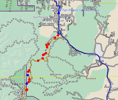
Between the Manzanos and Socorro:
- I followed the Grand Enchantment route, and it would be cool to get an easement through the pictured Ten Points General Store.
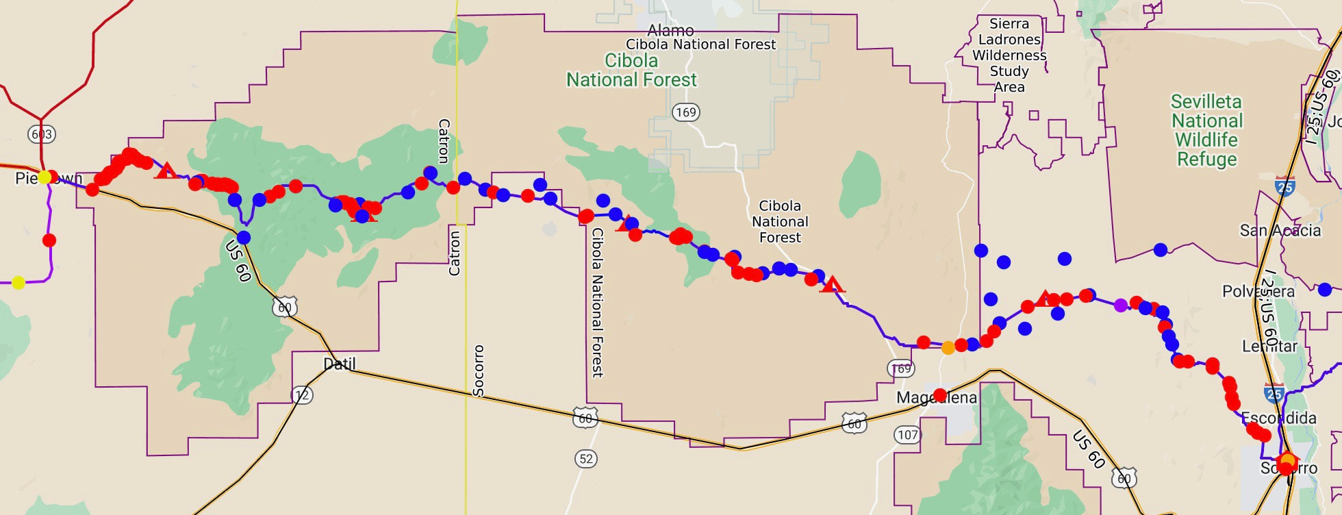
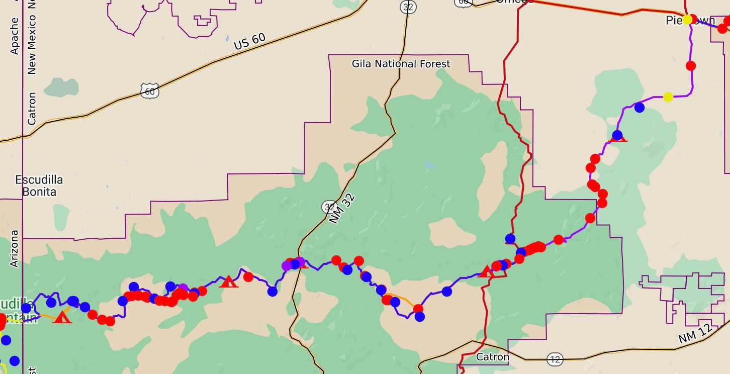
Between Socorro and Pie Town:
- Somee checkerboard-style private property issuesexist between state land parcels west of Socorro until you reach the Cibola National Forest. Maybe realigning the route with the already established Grand Enchantment trial would work when you leave Socorro. Still, I was trying to avoid swinging north to come back south, so I headed directly west and did run into the back side of some property lines I did not know about before starting the trip.
- North of the Very Large Array, there was no east-west passage near any water I knew of, so you can see I slightly dropped. The area was extraordinarily candy in areas. Just south of the forest boundary, I ended up running into the back side of a sign, and the sign made it clear I was not wanted. I did not see the sign on the east side. So, to alleviate this, this is a great area to build a new trail east-west running trail that stays within the National Forest.
- I ran onto some property boundary signs near Pie Town on the western side of the National Forests. So I walked along the fence line. This worked, but a trail could be built to join the CDT in Pie Town.
- Note that this area was arid, and I found most of my blue water dots dry or did not investigate. I went 54 miles between water sources in this section, so running the trail past known water sources from ranchers is essential. Thank you to the ranchers for pumping water to the surface; if it was not for them, I feel New Mexico would be complicated to hike across.
Between Pie Town and the Arizona boarder:
- This section went pretty well; yes, there was some dirt road walking as I headed south on the CDT, but it was cool to meet the CDT hikers heading north. Overall, improvements can be made because I did follow a lot of infrequently used dirt roads in the area and did some cross-country travel, but I enjoyed it. This section is a lower-priority area.
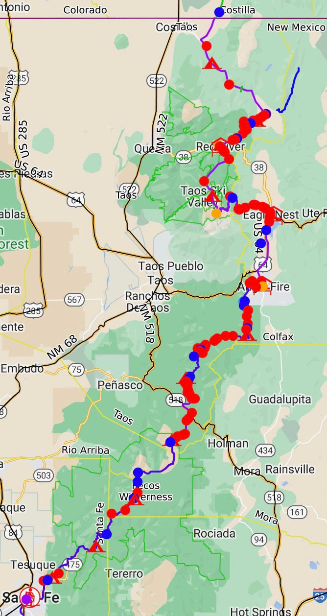
Let's not forget northern New Mexico from the Colorado border to Santa Fe:
- Right now, only a little is needed on the part of the FCL from Colorado to Santa Fe. Yes, there is some road walking through the Rio Costilla Ranchers Cooperative. However, the people I met associated with the cooperative were excellent, and the cooperative had an historic history.
- There is a section from Wheeler Peak to reach Eagles Nest that could use an easement to hike through.