|
Monday, April 26 Today I entered Pinetop Arizona my 5th resupply town. It is a nice town surrounded by Ponderosa Pine trees. The distance from Alpine Arizona to Pinetop was approximately 77 miles, and took me five days to hike. My High Point was at 9,500 feet, and can be described as open countryside edged with forest, which included Spruces, large Aspen trees, Ponderosa Pine trees. Within the trees were snow patches were blown into drifts by the winter winds. The melting snow created a fresh feeling in the air. The clear prairie like settings were free of snow. Due to the snow recently melting I had plenty of water sources. A big portion of the last section was following the Apache Railroad Trail. This was a railroad in the early 1900s that was put in for logging the area and getting the large Ponderosa Pines trees to the mill. The Apache Railroad Trail is a 21 mile long bike path that is mostly red lava rock and was pleasant to walk along. I think it would be a lovely place to ride a bike. It was nice that the Forest Service had underpasses where it went under a road that had very little traffic. During the section I had my first snafu, I stopped to take a break and realized I was missing my solar panel. I determined I left it 4 miles behind at my prior break location, so I was planning on leaving it behind, but then I decided this is not what The Animal does, he turns around, goes back and gets his stuff. Plus by the time I retrieve it, my battery will be fully charged. So on April 24 I had the pleasure of hiking 22 1/2 miles for the day but only had forward progress of 14 miles. It even gave me the opportunity to cross the high point of the day three times. Personally I actually enjoyed going back for my stuff it was a good way to make all of you laugh. April 25, I was quite tired because I don’t think my body likes doing 22 mile days, it prefers 17 to 19 mile days. Hiking along the route I was sluggish and slow moving, one way to get the body moving is pancakes on the side of the trail. Yes you read the word right, “pancakes”. Included was an apple, a banana, juice, and water. What does all this mean it means I received trail magic. Ronda and Jeff Johnson who were camping in their RVs by the side of the trail with their children, they we’re wondering what a strange bearded man was doing walking down the jeep road, so she came up and said what are you doing? This turned into a lovely discussion with her and her family and resulted in a pancake breakfast. So here’s a cheers to Ronda and John for providing awesome unexpected trail magic along the way. It gave me the energy and pep I needed to get to my next adventure, which was a prescribed fire. Yes, this is correct a prescribed fire. There was no sign when I started hiking down a trail that said hey there’s gonna be a fire ahead. Archers upon archer of burnt land I passed, so as I hiked on the land started to smolder and I thought it looked like a prescribed fire. As I hiked further I encountered more smoke, and then there was 10 to 12 foot flames on the side of the trail when it torched one small tree. At this point I thought there should be people tending to this fire so I did call 911 to let them know there was a fire. It was creeping up the hill, torching small bushes, I wasn’t sure what it would do when it got to the other side of the pass. After the 911 call I continued hiking to get away, when I got to the other side of the pass it was already burnt, so I knew the fire I saw a really wouldn’t spread anywhere. It was quite toasty walking by the fire, and I’m sure a lot of you saw it on the Facebook page. Later that day walking through some lovely trees I ran into the owner of the Pinetop Brewery, mountain biking with his two daughters. He was quite proud of them because they were on the mountain bike team. We had a lovely talk and upon reaching Pinetop I decided to go to his restaurant and have dinner for the evening. Somebody from the northwest who likes IPAs would not have been disappointed. Inside the brewery I met a man who thinks I should write my own book about my adventure. He was a writer named Les Roger and his book is titled “Rollovers, Rattlesnakes and UFOs: ... and Other Wild West Adventures”. We had a very meaningful conservation and he was sure that me being who I am and not living in fear is brining joy to many people. I agree! Here is the written description of his book, sounds interesting. Rollovers, Rattlesnakes & UFOs is a fascinating spiritual memoir depicting the power of trust and how to stay positive through life’s trying and extraordinary experiences. This modern day “Wild West” adventure has a take on life’s occurrences that give deeper meaning to our existence than what meets the physical eye. The eight compelling true-life stories are a breath of fresh air, even when they leave you breathless. You will rediscover your soul all over again Tomorrow I meet up with my friend Forrest Fanara who just moved down to Flagstaff, he’s going to hike out with me spend the night, and he will hike back to his car I will continue on to Forest Lakes which is about 79 miles away. I’m looking forward to continuing my hike through the worlds largest Ponderosa Pine forest, and there is snow in the forecast. Thanks for reading The Animal
6 Comments
Wednesday, April 21
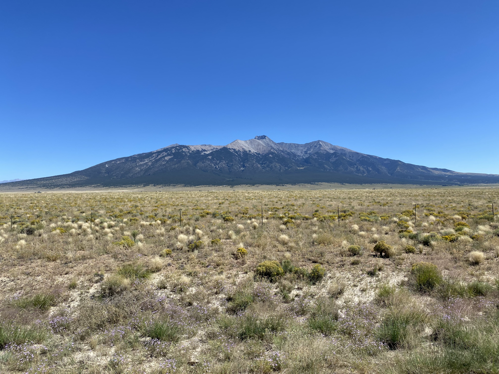
The section of the Four Corners Loop from Pie Town an New Mexico to Alpine Arizona was filled with joyful memories about the Continental Divide Trail from the start, then shifted into learning and observing the unknown after leaving my prior stomping grounds of the Continental Divide Trail. A lot has changed in this area, I discovered a random shower built in the middle of nowhere for CDT hikers. This made me laugh and smile. I had to take a shower, it was hot and amazing. This section also rewarded me with a test of “water management endurance” due to the dry conditions on trail. Ultimately, I walked 58 miles between water supplies. I left a newly developed well water source, and did not know it would be 58 miles until I reached another cow watering tank. The goodness of people, and pure luck in the section did provide me two unknown sources of water. My water was supplemented by two I Mexican Spotted owl biologists who gave me three liters of water at dusk in a random infrequently used jeep road. This was pure luck for me. I thought about turning them down because I thought I had a good source the next day, but they were going to hoot for owls, then head out for town and had 14 gallons in the back of their truck, so I accepted the “Trail Magic”. My water was also supplemented by a snowstorm where I hard-packed my empty bottles full of snow because I was unsure where and when the next water would be. The serious lack of water ended when I approached a cow trough I was sure would be full of water. My confidence came from looking at it on the satellite many times at many different times of the year. I could tell this was a new cow trough, well-managed and I just had a feeling it would have the elixir of life contained within it. I loaded up with 9 L of water about 18 pounds added to my pack. I knew this would get me to Alpine Arizona. I have the capacity to carry 12 L of water on me during this hike. Right after I entered Arizona I saw my first stream on the Four Corners Loop and then another and then another. So far a total of four streams have seen in Arizona. The only flowing stream I saw in New Mexico was the Rio Grande River. Most of Arizona is currently in an exceptional class five drought. The highest severity of drought levels. I am going to use the same caution I did on the last section, and choose to carry the weight in water, because keeping my body hydrated is important for good function and continuation of this amazing journey. What about the scenery. As I traveled from East to West, the trail gained more and more elevation. There was a high 9600 foot lookout I went over, Mangas Mountain 9,691’. The elevations around 8000 feet were predominately Ponderosa Pine forest. When you gain in elevation you begin to see Aspen trees, Douglas Firs, Blue Spruce, and Engelmann Spruce trees. The higher elevations, there was a coolness in the air. The travel was easy, with a mixture of high-quality dirt roads, some jeep roads, and a very large portion of cross country travel. I’m finding cross country travel in New Mexico and Arizona is very easy. Especially with the Ponderosa pine trees, they leave a soft cushion of needles for your feet to enjoy. When in the woods all you have to do was walk and enjoy the mighty large, old, gnarly trees, while following elk paths. These were punctuated by open expanses. One cool brisk morning while walking in the open, I was paralleled by a wolf. I would watch the wolf, the wolf would watch me, I would stop, the wolf would stop. We were both spending our time watching each other, wondering if the gap between us would increase or decrease. Then before I knew it the wolf was gone never to be seen again, prompting me to take a lunch break and relish in the shared moment. Similar to prior sections I saw several herds of elk in this section I have a feeling the sighting of elk will continue for miles to come. When I entered Arizona my emotions were high. This was a glowing experience for me, and remember when I glow you glow. I was greeted by a horny toad lizard basking on a road in the sun I thought it was a great sign to welcome me to Arizona with a lizard, thank you earth! As mentioned above there was a lack of water. The general cool temperatures for the six days really helped manage my water consumption as I continue on tomorrow I will continue to have cool temperatures. One day it was quite snowy, ending with a sunshine window, I got up at 1 PM packed up was able to move 8.1 miles before it begin to snow again, so the short duration day acted as if it was almost a rest day. There was another day where I took about two hours eating lunch just sitting up looking into the branches of a mighty Ponderosa Pine tree. I encountered some loggers doing forest treatment clearings To reduce the risk of catastrophic wild fire. I had a good conversation with them, and yes they shared their contentions with the Forest Service and how they were only allowed to cut the smaller trees. The cut trees were sent for the mill to make wood-stove pellets. I enjoyed this conversation because during the snowstorm I listen to several podcasts by Oregon Public Broadcasting called Timber Wars, which I recommend. The town of Alpine is small, there is only one place to eat food, and the grocery store doesn’t have much. I am very glad I sent myself the food I need to get to Pinetop Arizona about 80 miles away. Tomorrow when I leave it appears I gain some more in elevation so I’m expecting to hike with aspen trees, with open areas of grassland. Thank you for reading, The Animal Wednesday, April 14
Pie Town New Mexico. It feels good to be here. It has been 17 years since I last walked into Pie Town. Early May 2004 Garlic Man and I hiked here to have some pie which was wonderful. Our server said we have to meet Nita at the Toaster House. We learned this was the local hiker hostel. When we knocked at the door a young lady named Prairie wearing just a towel invited is in and said make yourself at home. Coming from a larger the city I thought this was strange, but it was a good place to rest. I never met Nita in 2004 and we thought we were missing a large part of Pie Town. Seventeen years later while I walk the FCL I smiled as I hiked into Pie Town again, and of course the pie is wonderful but there is a bonus! I got to meet Nita. I told her the the story about the young lady in the towel, she said that sounds like her daughter Prairie. Nita is a trail angel to the extreme. She has been inviting hikers into her home since 1982. Today I am here with three CDT hikers, two Great Divide bike riders, and another trail angel who is helping CDT hikers. I even missed Freebird by 45 minutes. He is a hiker from my PCT 14 hike that still makes me smile. I missed him because I was busy eating pie. Now that you know I am smiling in Pie Town what did I experience since leaving Socorro New Mexico. The answer is simple: hiking in sand, hiking into the wind, cross country route finding which I love, and stirring up herds of elk. I captured a video of several New Mexico gray wolves chasing a herd of elk. It was an amazing site to see nature work. To the best thing about the Socorro to Pie Town section was experiencing the elk. I also climbed Davenport Peak 9,354 feet. There is a lookout on top that was staffed. I could not enter because of COVID, but this was fine with me. It was nice seeing him attentive to his job. We were talking and he abruptly stops picks up the binoculars looks in the distance, then says “no fire, just a car driving down a dusty road”, then continues our conservation as a normal course of operation. I will be spending the night at the Toaster House and after having pie for breakfast I will be on my way to Alpine Arizona. The next section is 115 miles and should take about one week to walk. I am currently 335 miles into my walk. Happy Trails The Animal A distance of 231 miles of hiking in 12 days, what are my reflections about my dream of a new National Scenic Trail I call the Four Corners Loop. I am calling this a mini reflection because there is so much that awaits exploration, and I also know that 231 miles is also not insignificant to many.
Unsurprisingly to me the first two sections from Santa Fe to Tijeras with a bonus stop on Albuquerque, and from Tijeras to Socorro went as well as I could plan. With two exceptions both caused by weather and climate. The region is currently in a class 5 drought, the most severe. There was also a large late season snow storm that blanketed the high over 10,000 foot Sandia and Manzama mountains with up to four feet of fresh snow. Fresh snow is not consolidated and has no body weight holding power so post holing up to my thigh caused me to bush “post hole” to the road that leads up to Sandia Crest at 10,600 feet. I then route found my down the West side of the mountains descending over 4,000 feet and half of it was in snow on a steep trail with cliff bands below me. It took me five days to reach Albuquerque so a rest day with Larry and Marsha parents of my friend Patrick was a must. Remember the drought? Water in this section was very scarce. Only one windmill provided water. I purchased two gallons in Madrid because the town does not drink their water due to the high sulfur content. I then chose to support the local economy at the general store. Madrid is a historic mining town that has been inhabited by artist squatters I was told. It was quite an eclectic town popular with motorcycle riders. Good conservations were had at a distance. There was a lot of road walking mainly along New Mexico highway 14 due to private property along the route. I can see future negotiations with land owners relocating the route to off highway locations. Since I did an up and over hike of the Sandia Mountains after leaving Albuquerque Larry dropped me off via automobile at an appropriate stop on the East side to ensure I had a continuous foot path. I took the Fallon trail, a lower North to South trail that had little snow but high in tree diversity. It was such a pleasant walk in the woods. I quickly passed through Tijeras my first resupply. It is just a post office location and a Subway, not much more to say. There is a Forest Service station where I thought water was available but everything was off and no one was there. From here I took a network of mountain bike and motorcycle trails through the woods and they were enjoyable with many options. These trails ended when the forest boundary ended forcing me onto another road avoiding private property again. The silver lining was a small grocery where I purchased two gallons of water, and the clerk talked of climbing Liberty Bell in Washington. After more road walking I “found” my way up to the national forest, discovering two water sources I did not need. My travels brought me higher and higher up into the snow along the crest of the Manzama. Eleven miles of post holing occurred with zest and joy. It gave me a thrill because I love using my well honed trail finding skills. When the trail is obscured, buried by snow I love to call my route an “Animal Path”. The Manzama Mountains quickly lost their mighty height to the desert below. At the foot of the mountain I found a critical spring near a forest service campground, when a rancher appeared on his ATV stating this was the driest he has ever seen the spring. How would the drought effect the dry 60 mile stretch across the low desert lands ahead? Just North of US60, on my website you would have seen me diverge from the line shown on my map. I was not lost, but following better route advice learned from the Grand Enchantments Trail (GET). From Alberquerque to Socorro I was basically following the GET. This is a trail that people take from Phoenix to Alberquerque. South of US60 is a a mix of private ranching land and Bureau of Land Management (BLM - “Bureau of Livestock and Mining”). Actually I passed a wildernesses study area along this section. This section comprised of some cross country travel. I thought avoiding cactus would slow me down, they were easy to avoid. One of the days I even hiked 24.8 miles because it was very windy and there was no use in stopping to camp in the wind so I just kept walking. Couple this with 18 miles the following day only stopping to rest once to reach Socorro. Interesting I think I know why my left foot hurts. So I am resting in Socorro today, picking up a resupply. My left foot could be an issue, it does have me concerned. I need to take more short rests and not hike for four hours straight before resting. So in summation is what I hiked so far worthy of a new National Scenic Trail. I say YES! I also know it will get much better and more scenic as I venture along my chosen Animal path. |


