|
Omnipresent Bobsled Ride
I am one month away from starting another epic hike of my awesome life. Right now my thoughts feels like an omnipresent bobsleds ride. The thoughts in my head are constant, like a bobsled driver visualizing the course, knowing exactly when to drive into a bend, creating the winning ride, success, and happiness as all cheer. I have spent the last three years preparing to be a winning bob sled driver, as I hike along the route. I feel as if I know every bend, every straight section, every hill, and every valley. But I don’t! It is the fine granular details that are missing. The ten foot deep wash filled with tumbleweed which must be crossed. A fallen ponderosa tree, the flower with a bee, and lichen on a rock next to me. As the bobsled driver descends the track every ice groove and bump jostling the driver is felt, leaving the crowd on edge as to what will happen. I will encounter unknown bumps too, but I will smile as I drive my sled down my visualized path. If I crash it will be you, the crowd watching me who gives me strength to pick up the pieces learn from what was not known, and make adjustments to continue down the course. I am on the course now in my head and I am thrilled to have you the wonderful crowd cheering me on, gaining smiles as I zoom along creating the Four Corners Loop as a new National Scenic Trail. Thanks and get ready for a ride. Kevin Koski - The Animal
1 Comment
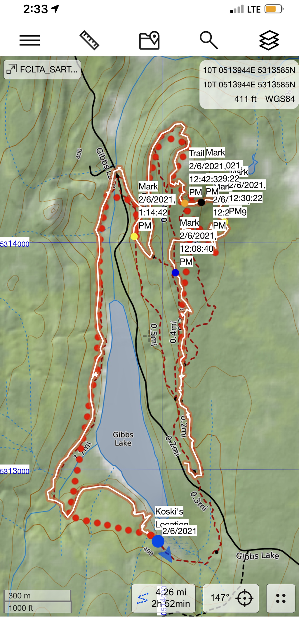
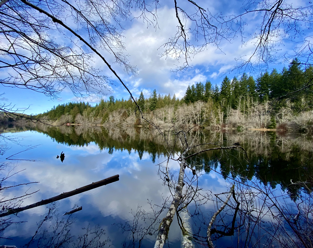
I tested my tracking capabilities today. The red dots represent my Garmin InReach “data”. Every time it takes a bend is where the InReach communicated with a satellite. It then makes a line of the area between the nodes. The orange line with the white stripe in the middle represents my actual GPS location data for my phone. I was an area that had cell service so it was able to upload it to the map. I tested low resolution, medium resolution, and high resolution. I determined that this uses way too much battery life on your phone. I plan on using what is called extended tracking for my InReach. This will enable me to save a ton of battery life because it is not communicating by Bluetooth to my phone. This will also enable me to turn off some functions on my phone if I need to save more battery life. Today was a good test I determined that using my InReach to place the red dots on my map is the best method to save the most amount of battery life. Gibbs lake is pictured above and it was the wonderful lake I walked around today.
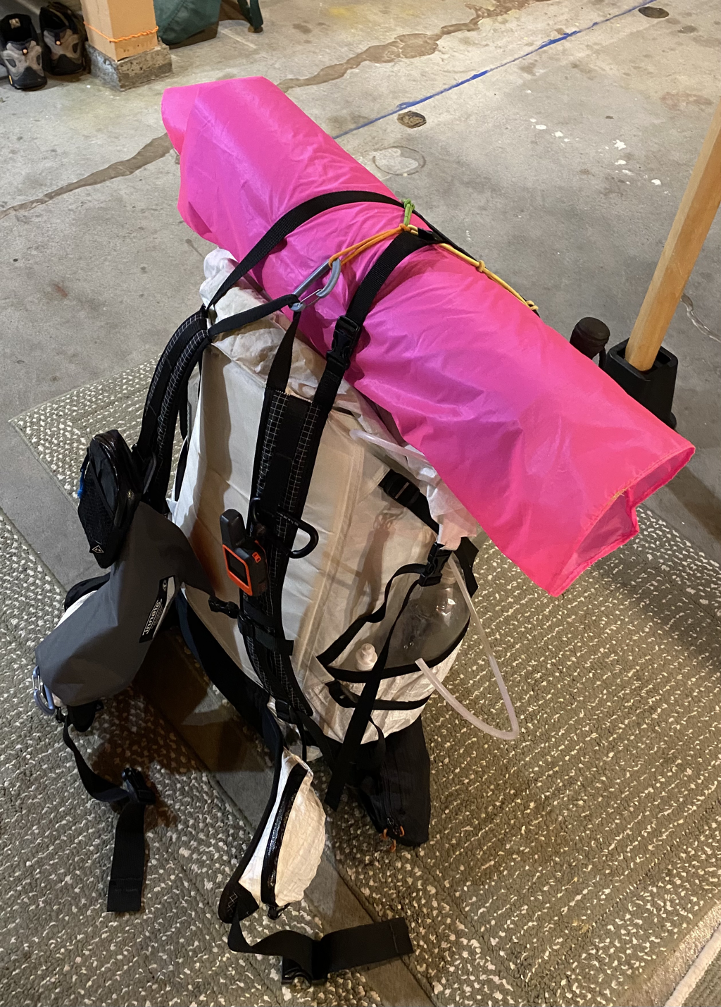
Pictured here is my base pack with no food or water. Everything in this photo weighs 18.3 pounds.
I am happy with it, and I am running out of ideas how to save more weight because I do have a safety margin and I’m not willing to cut out stuff that I feel I need. Add upon this anywhere from 10 to 17 pounds of food per resupply. Water is heavy, 2 pounds per liter. In this pack I have the capacity in empty bottles within to carry 12-1/2 liters of life giving water, so if full add 25 pounds. I would estimate that for each resupply I will start out with a 40 to 45 pound pack. Some sections that are very dry I could easily start out with up to 55 pounds. The nice thing is you drink water and you eat your food so your pack always gets lighter as you approach the next town. |
