 Five days of hiking was necessary to walk from Santa Fe to Alberquerque. I pushed my body hard walking approximately 91 miles. The post holing through deep snow at the top of Sandia Crest at over 10,000 feet was hard since I was just at sea level.
The picture above shows the wildernesses boundary sign as I leave the wildernesses and approach Alberquerque for a day of rest. Two hours prior I was in four feet of snow, and now I am surrounded by cactus. The route went as expected, except the deep snow because I thought there would only be about a foot on the crest. I also expected people I encountered along the way to be nice, and this is true. I was offered a beer over a barb wire fence, and Delphine & Camellia chatted with me how the Fallon plate subduction and continental rifting created the Sandia Mountains. I laughed because this strangely made me think of Maria. (I know Maria is laughing now, during COVID we watched a college geology lecture series that talked about this, now two people on trail are telling me about the New Mexico rift.) I am enjoying my day of rest with Marsha and Larry parents of my friend Patrick. I was just greeted by their corgi as it hopped into the bed, but who’s legs were too short to hop off. This made me laugh. I am looking forward to what is to come because the start has been very enjoyable.
3 Comments
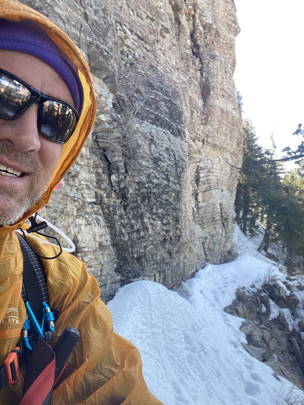 I just desended 1900 feet down that Luz trail on the west side of Sandia crest. It was pretty amazing I’m very glad I had one prior set of foot prints showing me the way, with the route stomped in front of me I still had to be careful because there were some drop off‘s but generally it went pretty easy.
Tonight I will be in Alberquerque visiting Patrick’s parents, and I need more food. I somehow already consumed most of what I started with. to sum up my adventure so far knowing I am only on day five - splendid.  The pre-hike relaxation time with Maria in Santa Fe is warming our hearts with laughter. Slowing down, walking with Maria, appreciating the omnipresent art, strolling from gallery, to park, to an adjacent adobe wall, this will allow me to conjure up my memory with a smile. It will give me strength, and smiles when needed on my journey through the spring, summertime, and fall.
I love you Maria, we will miss each other, our love and happiness will be sprinkled about like the soft snow that is floating down upon Santa Fe. Both of us will share our love, all summer long with everyone we meet. Tomorrow the Four Corners Loop walk starts, I am relaxed and ready for the adventure I love. Santa Fe is adorned with Saint Francis the patron of Animals, which is quite fitting, and gives me comfort. FCL you are about to be visited by The Animal. Thanks for reading Kevin Koski - The Animal My neighbor asked me how I was planning to honor the indigenous land that I will be crossing in my trip. Immediately I replied “I planned the route to not cross any reservations so I need less permits.” I also though in the time of Covid tribes do not want people on their reservations.
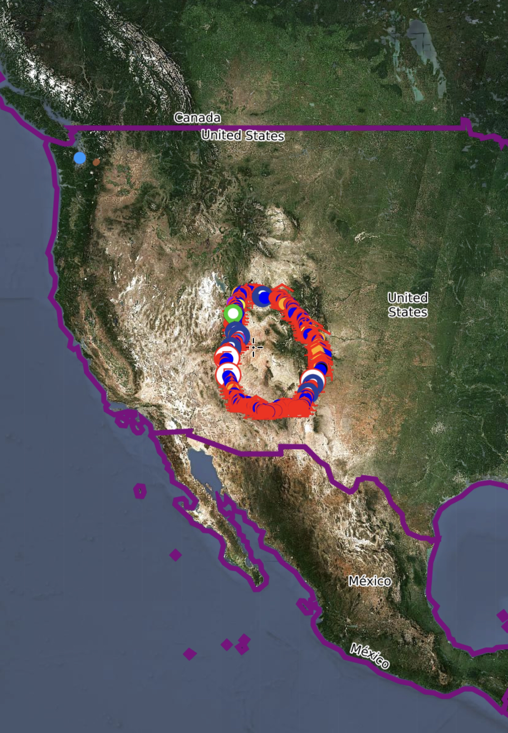
I quickly realized I did not fully understand the questions and the answer gave showed my ignorance. She was talking about all land, because the land I walk across was cared for by a vast number of Native American tribes for centuries. I have spent some time thinking about my first quick response and realize it came from my lack of education and a lack of respect. I live in the Pacific Northwest, the land of the Salish people. I am minimally aware of the history of indigenous people in my area, and with my limits of knowledge I have always felt that indigenous people got robbed of their land. For example, is the Yakama Nation’s reservation located where they traditionally lived most the year? The answer is an unsurprising no. They live off the abundant Columbia River salmon runs, but their “reservation” lands are not along the Columbia because they were robbed of their land along the river. It continues to this day, the Colville tribe were recently robbed of their entire livelihood when the Grand Coulee Dam was developed cutting off the flow of salmon. The absence of salmon above the dam continues to have negatively effects for the Colville people. Can I say I am educated on the indigenous people of the Salish sea, because I have typed a few sentences here. A few sentences that are based on some reading, but probably mostly opinion. An opinion which lacks basic knowledge of their struggles caused by the forced changes of the white man in search of resources. If I neglect to honor the indigenous lands of the Salish Sea, do I have the knowledge or capacity to truly honor the indigenous lands I will travel through while hiking the Four Corners Loop. At this time my answer to the question is no. I don’t know enough. I have not lived on and not cared for the lands for over 10,000 years like Native Americans have. They know the land and I am only beginning to enjoy it as they have done for centuries. I appreciate my local radio station KEXP 90.3 because they frequently make public service announcements acknowledging the fact they are broadcasting from the land of the Salish and Duwamish people. Acknowledging native peoples and their land they cared for is a start and I look forward to learning more as I travel. It has always been my plan to learn about the land, and the people on the land as I walk for six months. I do look forward to learning about the indigenous people of the Southwest. I tried to honor the region with the creation of the Four Corners Loop Logo the sunset and the juniper tree, but now it is time to honor the indigenous tribes who’s land I will be traveling through. I would like to thank and honor the following tribes for who’s land I will enjoy and you will enjoy by following me. I will respect the land for its beauty and honor it as you have for a long time. Cheyenne Chiricahua Apache Comanche Diné Bikéyah Eastern Shoshone Havasu Baaja (Havasupai) Hohokam Hopitutskwa Hualapal Jacarilla Apache Mescalero Apache Nuwuvi (South Pairte) Pueblos Shiwinna (Zuni) Shoshone - Bannock Taos Pueblo Ute Western Apache White Mountain Apache I know I will be awed by the views, sounds, silence. I look forward to learning more as I walk which will enable me to respect the land and take care of it as you have done for a very long time. Respectfully, Kevin Koski  Omnipresent Bobsled Ride I am one month away from starting another epic hike of my awesome life. Right now my thoughts feels like an omnipresent bobsleds ride. The thoughts in my head are constant, like a bobsled driver visualizing the course, knowing exactly when to drive into a bend, creating the winning ride, success, and happiness as all cheer. I have spent the last three years preparing to be a winning bob sled driver, as I hike along the route. I feel as if I know every bend, every straight section, every hill, and every valley. But I don’t! It is the fine granular details that are missing. The ten foot deep wash filled with tumbleweed which must be crossed. A fallen ponderosa tree, the flower with a bee, and lichen on a rock next to me. As the bobsled driver descends the track every ice groove and bump jostling the driver is felt, leaving the crowd on edge as to what will happen. I will encounter unknown bumps too, but I will smile as I drive my sled down my visualized path. If I crash it will be you, the crowd watching me who gives me strength to pick up the pieces learn from what was not known, and make adjustments to continue down the course. I am on the course now in my head and I am thrilled to have you the wonderful crowd cheering me on, gaining smiles as I zoom along creating the Four Corners Loop as a new National Scenic Trail. Thanks and get ready for a ride. Kevin Koski - The Animal 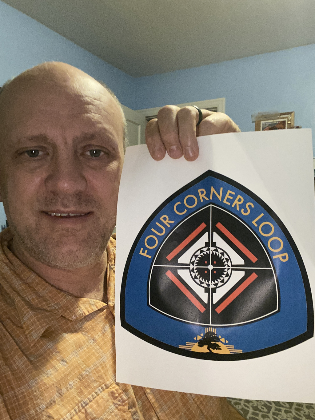 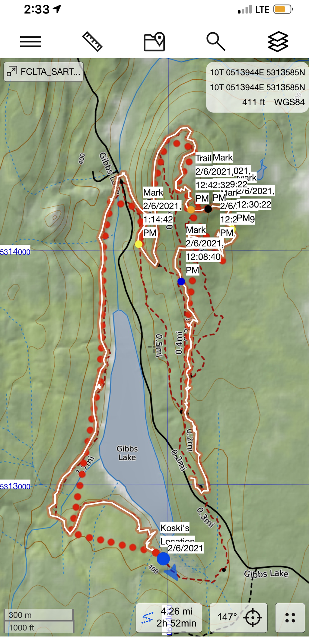 I tested my tracking capabilities today. The red dots represent my Garmin InReach “data”. Every time it takes a bend is where the InReach communicated with a satellite. It then makes a line of the area between the nodes. The orange line with the white stripe in the middle represents my actual GPS location data for my phone. I was an area that had cell service so it was able to upload it to the map. I tested low resolution, medium resolution, and high resolution. I determined that this uses way too much battery life on your phone. I plan on using what is called extended tracking for my InReach. This will enable me to save a ton of battery life because it is not communicating by Bluetooth to my phone. This will also enable me to turn off some functions on my phone if I need to save more battery life. Today was a good test I determined that using my InReach to place the red dots on my map is the best method to save the most amount of battery life. 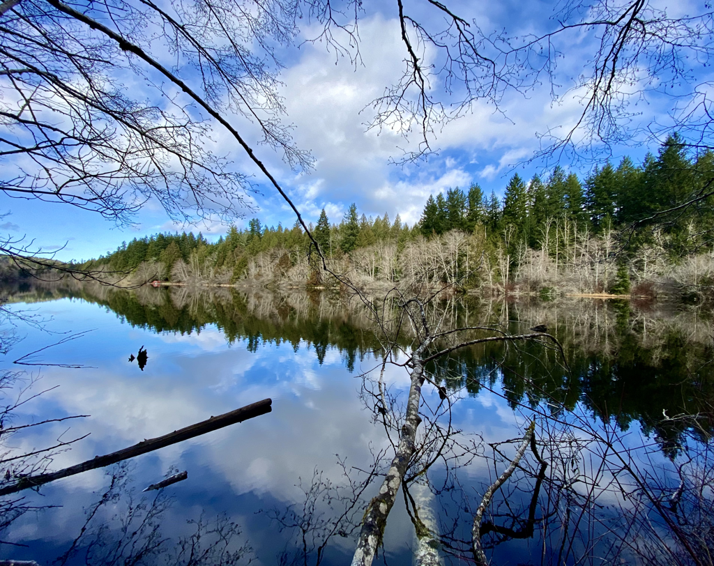 Gibbs lake is pictured above and it was the wonderful lake I walked around today.
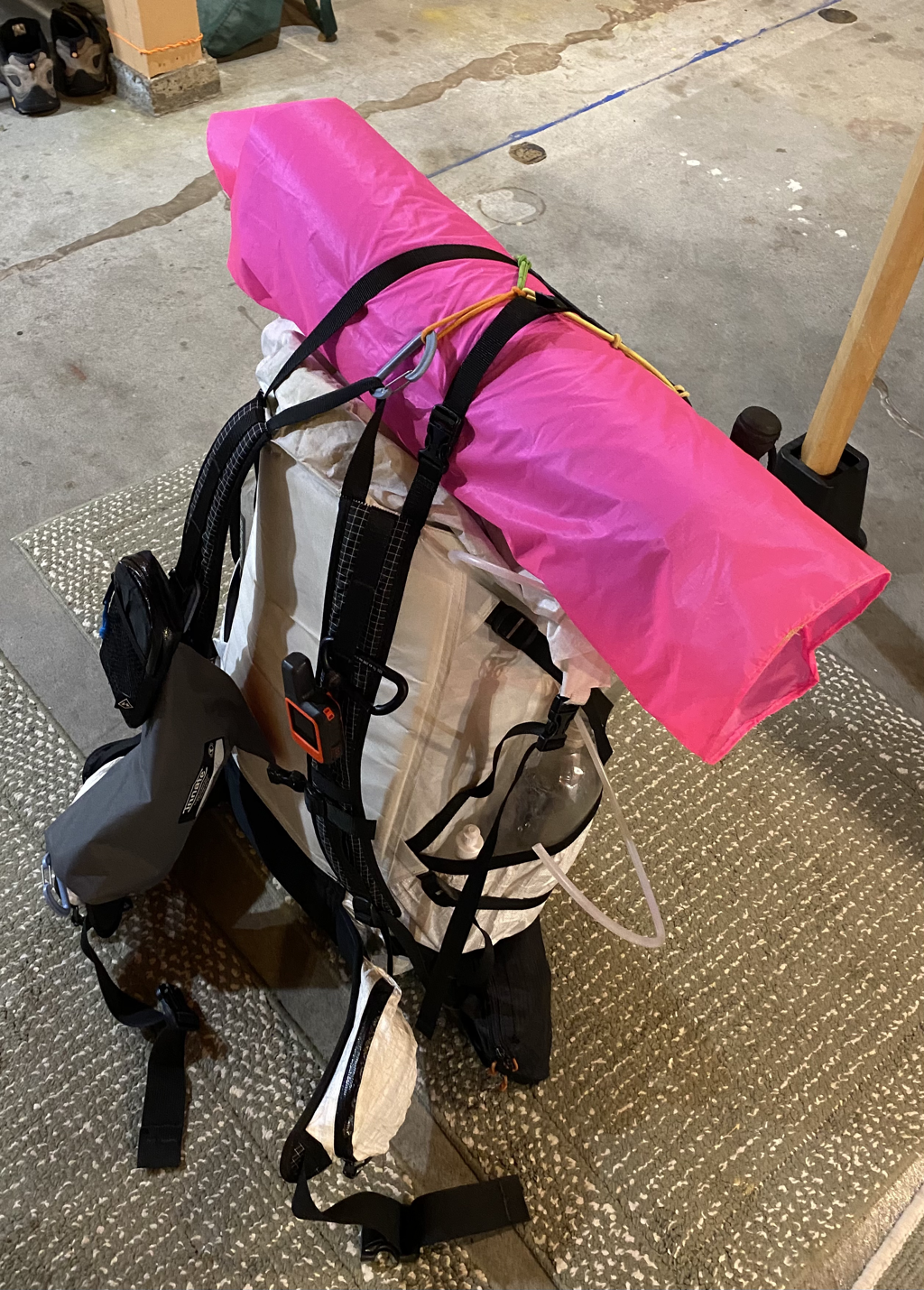 Pictured here is my base pack with no food or water. Everything in this photo weighs 18.3 pounds.
I am happy with it, and I am running out of ideas how to save more weight because I do have a safety margin and I’m not willing to cut out stuff that I feel I need. Add upon this anywhere from 10 to 17 pounds of food per resupply. Water is heavy, 2 pounds per liter. In this pack I have the capacity in empty bottles within to carry 12-1/2 liters of life giving water, so if full add 25 pounds. I would estimate that for each resupply I will start out with a 40 to 45 pound pack. Some sections that are very dry I could easily start out with up to 55 pounds. The nice thing is you drink water and you eat your food so your pack always gets lighter as you approach the next town. 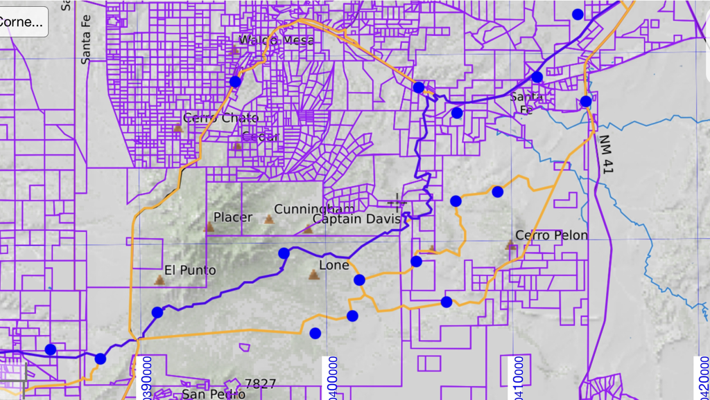 The Four Corners Loop is massive, so one is bound to have private property issues how do you get from a public land to a public parcel of land. One tool are used also came from my mapping software which still shows the tax parcels. This gave me an idea of who to look up and who owns what. Long story short, I need to write some letters, specifically to two very large ranches in New Mexico.
In the map above the lower orange lines pass to these two ranches, they also passed through some Bureau of Land parcels, and New Mexico state land. As far as I can tell I can just walk across the BLM land because this is owned by the public. The state land of New Mexico I need to get a $35 permit for. It is the large ranches I need land owner permission. Time to write a letter or two, or three, or four. Otherwise I’m gonna have to walk roads. The only area along this entire road that has significant private property issues is when I start south of Santa Fe. I almost called this trail the “western public loop” because the vast majority of it is public land that you and I own. I am very optimistic I will get permission because I will put it out there in the universe will listen. The Cocoon sleeping bag liner sold at REI is always too narrow for me, and I keep tearing it to shreds. I got tired of replacing a $60 piece of gear, so I bought my own silk which is a pretty orange and can be used for an emergency attraction device. Using the orange silk made my own wider silk bag liner. It is open on one side eliminating stress points which caused tearing of the Cocoon brand. It is a good thing I had sewing class in middle school.   Planing and preparing for my hike on the Four Corners Loop is on schedule for 2020. As we approach 2021 tomorrow, I feel like my planing and packing efforts will continue to fall into place as they always have. Why is this the case? Because my positive thoughts are creating my future. Everything I have always thought about has taken place. I am always thinking about what I have to accomplish, then taking action on my thoughts. So through actions directed by my positive outlook I will be ready for my planned adventure and I am ready to share it with you.
I want to share my experiences, so you feel like you are traveling along with me. For you to experience the FCL, I need to describe the views, smells, winds, sunny days and old clear nights. The darkness of the night sky speckled with stars and the glorious Milky away will be lived under as I will also live under moon shadows cast by the towering sandstone cliffs. People and small towns will be part of my experience as will long durations of time alone watching every rock and blade of grass pass behind me as push forward. So, for you to be part of the experience, I am about to package more food. Imagine placing 300 grams of food in vacuum bags, imagine the vibrating sounds of a vacuum pump, vibrating hands, as the package shrinks waiting for the “ready” green light. Stop and repeat for 120 pounds of food. I always thought a factory worker would make a good long distance hiker. I do like repetitive processes. |
